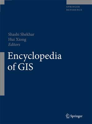
[GIS Book/PDF] Encyclopedia of GIS
Description
Издательство Springer, 2008, -1391 pp.The publication of a definitive Encyclopedia of GIS that lays out many of the computer science/mathematics foundations of the field is a major event, the culmination of a half century of development. I was part of the earliest stirrings in the mid-1950s. A small group of geography graduate students at the University of Washington, William Garrison’s space cadets, began to assemble what became the foundations of contemporary spatial analysis and to refocus mathematical cartography while working with civil engineer Edgar Horwood on his attempts to use the printers of the time to produce grey-shaded maps. Our attention was captured by Sputnik, however, we didn’t anticipate that the US’s response, the rapid development of NASA and satellite systems, would be the key to the equally rapid development of remote sensing, or that global positioning would rewrite cartography. Among the innovations of the time were Torsten Hägerstrand’s first simulation models of space-time diffusion processes and early econometric interest in spatial autocorrelation. Both themes are now central to spatial analysis.The GIS focus shifted when Garrison, Marble and I relocated to the Chicago region. Garrison and I helped fund civil engineer Howard Fisher’s first generation computer graphics software, SYMAP I, and Marble and I organized NSF workshops to spread the word and drew together an initial overview of the field in Spatial Analysis. Fisher took his ideas to the Ford Foundation and a subsequent grant to Harvard University, where he established the Laboratory for Computer Graphics. The Lab served as the focus for research in the field well into the 1970s, providing the spark to such innovators as Jack Dangermond, who subsequently established ESRI and created what became the world’s most widely used computer graphics software. Meanwhile, hardware development proceeded apace, as did imaging and positioning capabilities created by the Department of Defense and NASA, facilitating the resulting emergence of digital cartography and the establishment of the first large-scale Geographic Information Systems such as the Canada Land Inventory. The rest, as they say, is history – albeit given a new dynamic by the Internet and the continued evolution of computing capabilities both on the desktop and in the supercomputer.Fifty years after these beginnings, the result is a large and complex field spanning many disciplines, continuing to grow and to expand into an expanding array of applications. Cartographers have eschewed their pen-and-ink, and rudimentary mapmaking is at the fingertips of everyone with Internet access. Road atlases are fast giving way to satellite navigation systems. Congress continues to be concerned with the privacy issues raised by geographic information system capabilities, yet police and fire departments can no longer function effectively without GIS and Homeland Security without modern database and data mining capabilities. From city planning to store location, property taxation to highway building, disaster response to environmental management, there are few arenas in which GIS is not playing a significant role. What is important is the cross-cutting capability that was recognized when the NSF funded the Center for Spatially- Integrated Social Science (CSICC) at the University of California, Santa Barbara, or my own university’s Ph.D. program, a joint venture of the School of Economic, Political and Policy Sciences, the School of Natural Sciences and Mathematics, and the School of Engineering and Computer Sciences.I like to tell my colleagues that there are three levels of GIS education: Driver’s Ed, Mr. Goodwrench, and Design Team. Driver’s Ed provides essential skills to the broad base of software users, the Mr. Goodwrenches of the world learn how to put together and maintain working software-hardware installations, while Design Teams create new and improved GIS capabilities. Most of the new data handling capabilities reside in the arenas of computer science/ mathematics, while advances in inference are coming from innovations in the ability to handle space-time dynamics while simultaneously accounting for serial and spatial dependence.The Encyclopedia of GIS provides an essential reference work for all three categories of users. In contrast to the current textbooks in the field, which are keyed to Driver’s Ed, the Encyclopedia also provides a handy sourcebook for the Mr. Goodwrenches while defining the platform on which future Design Teams will build by focusing – more than existing works – on the computer science/mathematical foundations of the field. I know that the GIS community will value this important reference and guide, and I will cherish it as a milestone. It marks how far we have come – far beyond what our group of pioneers dreamed might be possible a half century ago. Professors Shekhar and Xiong and the considerable community of contributors to the collection have provided us with a comprehensive and authoritative treatment of the field, extensively cross-referenced with key citations and further readings. Importantly, it is available in both printed and XML online editions, the latter with hyperlinked citations. The GIS world will be indebted to them. No GIS bookshelf should, as they say, be without it.
Book Info

Author(s): Shekar S., Xiong H. (eds.)
Search in WorldCat | Search in Goodreads | Search in AbeBooks | Search in Amazon.com
Join Group
Due to copyright or some other issues, the resources you currently see may not be available, for more information, such as purchase, lease, second-hand transfer or other method, you can join our Telegram group, many other GIS tips would be shared here.
Telegram: Join GIS Hub Group
comments powered by Disqus