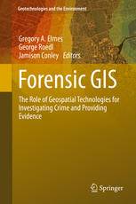
[GIS Book/PDF] Forensic GIS: The Role of Geospatial Technologies for Investigating Crime and Providing Evidence
Description
A variety of disciplines and professions have embraced geospatial technologies for collecting, storing, manipulating, analyzing and displaying spatial data to investigate crime, prosecute and convict offenders, exonerate suspects and submit evidence in civil lawsuits. The applications, acceptability and relevance and procedural legality of each geospatial technologies vary. The purpose of this book is to explain the nature of geospatial technologies, demonstrate a variety of geospatial applications used to investigate and litigate civil and criminal activities and to provide a reference of current acceptability of geospatial technology in the production of evidence. This book is an introductory overview designed to appeal to researchers and practitioners across disciplinary boundaries. The authors of this book are researchers and practitioners across disciplines and professions, experts in the field.
Book Info

Author(s): Gregory A. Elmes, George Roedl, Jamison Conley (eds.)
Series: Geotechnologies and the Environment 11
Publisher: Springer Netherlands, Year: 2014
Join Group
Due to copyright or some other issues, the resources you currently see may not be available, for more information, such as purchase, lease, second-hand transfer or other method, you can join our Telegram group, many other GIS tips would be shared here.
Telegram: Join GIS Hub Group
comments powered by Disqus