[GIS Video] How to Simulate flood in ArcGIS?
About Simulate Flood
Generally, floods are one of the most common natural risks to human beings because most of the populated areas in the world are vulnerable to flood disasters, whereas other natural hazards such as earthquakes, volcanic activities, landslides and avalanche are particular to certain regions only. In long-term analysis, flood disasters account for about one third of all natural catastrophes (evaluated by frequency of occurrence and economic losses induced), and cause more than half of the life losses due to huge flood-induced human cost in the developing and heavily populated countries such as China and Bangladesh.
Simulation Flood in ArcGIS
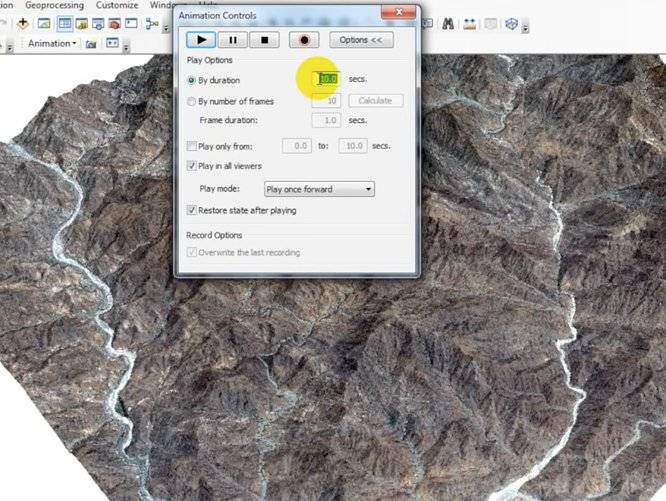
Simulation flood in ArcGIS 10.4.1 model flood 3d in ArcScene tutorial flood plain image and digital elevation model DEM simulation hydrology data in arcmap ArcGIS spatial analysis. Now use ArcGIS, you can simulate it conveniently and apace.
Watch Video
Join Group
Due to copyright or some other issues, the resources you currently see may not be available, for more information, such as purchase, lease, second-hand transfer or other method, you can join our Telegram group, many other GIS tips would be shared here.
Telegram: Join GIS Hub Group
comments powered by Disqus